

|
 |
 |
| |
State of Arizona Coloring Page Sheets
The 50 States coloring pages
|
|
Arizona coloring pages are a fun way to teach Pre-K through 3rd grade students history, geography and demographics,
and for elementary students to learn about their own (and other) states.
|
| LIST of States |
|


|


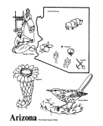
AZ - Arizona
Arizona Postage Stamp - USPS State Stamp
Arizona State Quarter - 50 State Quarter
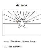
Arizona State Flag - State Flag to Color
Arizona Map - State Outline Map to Color
Arizona Map - Easy State Outline Map to Color
|
Arizona is a state of the United States of America located in the southwestern region of the United States.
The capital and largest city is Phoenix. The second largest city is Tucson, followed in size by the eight Phoenix metropolitan area cities of
Mesa, Glendale, Chandler, Scottsdale, Gilbert, Tempe, Peoria, Surprise and then by Yuma in Yuma County.
Arizona is the 48th state and last of the contiguous states admitted to the Union, achieving statehood on February 14, 1912 - the 50th
anniversary of Arizona's recognition as a territory of the United States.[4] Arizona is noted for its desert climate, exceptionally hot
summers, and mild winters, however it also features pine forests and mountain ranges in the northern high country, with cooler weather than
in the lower deserts
Please note, we gladly accept submissions from state and local government agencies and departments (Department(s) of tourism, agriculture, etc.)
for display of additional state coloring pages on our site. In addition we accept submissions from established and recognized industries, or local
places of interest (cities, parks, attractions) that may make available quality content that is specific to a particular state. Contact us if
you have the capability and authority to provide such content, we would be happy to promote your state, city, attraction, event, etc.!
*** State information courtesy of Wikipedia ***
|
|
|
|
 |
|


|

