

|
 |
 |
| |
State of Delaware Coloring Page Sheets
The 50 States coloring pages
|
|
Delaware coloring pages are a fun way to teach Pre-K through 3rd grade students history, geography and demographics,
and for elementary students to learn about their own (and other) states.
|
| LIST of States |
|


|


DE - Delaware
Delaware Postage Stamp - USPS State Stamp
Delaware State Quarter - 50 State Quarter
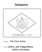
Delaware State Flag - State Flag to Color
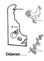
Delaware Map 1 - State Outline Map to Color
Delaware Map 2 - Easy State Outline Map to Color
|
Delaware is located in the northeastern portion of the Delmarva Peninsula and is the second smallest state in area (after Rhode Island).
Estimates in 2007 rank the population of Delaware as 45th in the nation, but 6th in population density, with more than 60% of the population
in New Castle County. Delaware is divided into three counties. From north to south, these three counties are New Castle, Kent, and Sussex.
While the southern two counties have historically been predominantly agricultural, New Castle County has been more industrialized.
The state ranks second in civilian scientists and engineers as a percentage of the workforce and number of patents issued to companies or
individuals per 1,000 workers.
Before its coastline was first explored by Europeans in the 16th century, Delaware was inhabited by several groups of Native Americans,
including the Lenape in the north and Nanticoke in the south. It was initially colonized by Dutch traders at Zwaanendael, located near
the present town of Lewes, in 1631. Delaware was one of the thirteen colonies participating in the American Revolution and on
December 7, 1787, became the first state to ratify the Constitution of the United States, therefore becoming known as The First State.
*** State information courtesy of Wikipedia ***
|
|
|
|
 |
|


|

